The Bras d’Or is a lake in Cape Breton, the large island off the northeast shore of the Nova Scotia’s mainland. Originally known as Le Lac de Labrador, the lake is a tidal estuary with connections to the North Atlantic Ocean. Labrador was the Portuguese name for much of present-day Canada’s east coast. Labrador means “farmer” in English; later French occupation saw the name changed to Le Lac de Bras d’Or (“arm of gold” in English.) Cape Breton is part of Nova Scotia and its estuarial lake was designated as a UNESCO Biosphere Reserve due to its unique mix of salt and fresh water. The ratio is about 50/50.
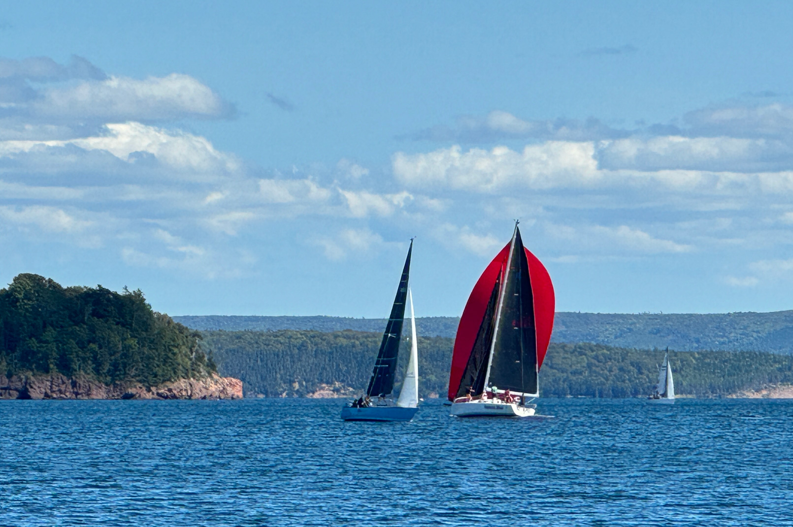
While it is known for excellent fishing, sailboats seem to outnumber all other boats by a considerable number. The main bay in the center of the island lends itself to fabulous sailing. You can decide where you want to go based on where the best wind is for sailing. And there are many safe anchorages throughout the Bras d’Or.
One More Lock
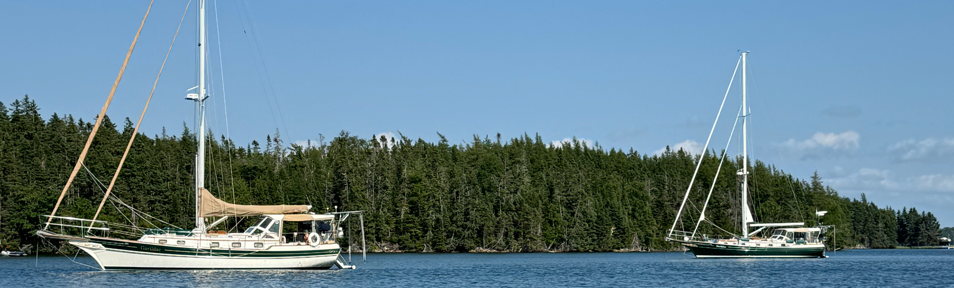
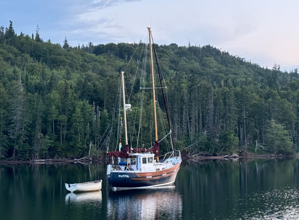
From the south, you enter the Bras d’Or via St. Peter’s Bay, a large bay outside the town of St. Peter’s. After cruising seven days from Tantallon in St. Margaret’s Bay to St. Peter’s Bay, we anchored behind a spit off Grande Greve Point, near the bay’s entrance. Since June we had been monitoring the progress of our previous boat, Gaviidae (a Gozzard 37), as it made its way down the St. Lawrence Seaway. By the time we anchored in Grande Greve on Saturday, July 27, the other Gaviidae was anchored twenty miles away on Isle Madame. We expected to see Gaviidae and its owners, Howard and Kerri-Ann (H&K), Sunday at the marina in St. Peter’s, but they caught up to us at Grande Greve that morning.
The Bras d’Or is accessed by a canal with a lock, which is also paired with a swing bridge at the north end of the canal. After leaving our anchorage in Grand Greve, both Gaviidaes headed for the lock and went through together.
This was the start of encountering people who could not understand why there were two boats with the same name, from two different countries (US and Canada), and who were traveling together. It was humorous listening to their speculations as they walked or paddled by. “They must be related”, “how could they have the same name?”, “is one a little bigger?” We actually had someone hail us on the VHF inquiring why we both had the same name.
St. Peter’s
The marina in St. Peters is run by the Lion’s Club, but the harbormaster is really the one that keeps the entire operation running smoothly. His name is Gerry, and he has an extremely positive attitude and is convinced that everything is possible. And somehow, he manages to accommodate all of the boaters and all of their unusual requests.
The marina has a boater’s lounge with a small kitchen and television. On Thursday evenings, it turns into a musical jam session and people from the area along with some of the boaters spend a few hours playing whatever they want. They take turns picking the songs, so it’s quite orderly. Some of the participants sing, another played a Scottish recorder, and the rest played guitars.
Most of the songs were sea shanties or of Scottish/Acadian heritage. There were a few members, who clearly were regulars, who played some blues. Dan would join in with his blues harp during those songs.
Cape George Harbour
After re-provisioning, doing laundry, and completing some other boat tasks, sorting out billing confusion with the two Gaviidaes, it was time to head out and explore. Our first destination was Cape George Harbour. It’s a lovely anchorage very popular with the locals. They arrived in their modified lobster boats and other runabouts and beach them on the shore around a protected spit along the entrance to the bay. By late afternoon, they would all depart leaving the anchorage to assorted cruising boats, including the two Gaviidaes.
Shortly after we arrived, a sailboat named Duo came in. Manned by a sailing couple from Quebec, we had met them on the dock in St. Peters and H&K had been crossing paths with them on their journey down the St. Lawrence. The man from Duo kayaked to both Gaviidaes and invited us to their boat for champagne at 8:00 the next day. At first I thought he meant 8PM but quickly learned that it 8:00AM!
The following morning, we dinghied over to join them for the start of her birthday celebration. She wanted Champagne for breakfast and that’s what we got. Wonderful way to start the day!
Maskells Harbour
After three nights in Cape George Harbour we sailed to Maskells Harbour, some 20 miles across the main basin. Before we weighed anchor, SV Grace, another Gozzard that is based out of St. Peters, cruised past Cape George Harbour. There was just enough wind to enjoy a beautiful sail across the bay to the Barra Strait Bridge. Three Gozzard sailboats sailing together!
Dana (from SV Grace) had recommended Maskells and he opted to join us in the anchorage. It was definitely a good recommendation, and we wondered why we had spent so many nights at Cape George!
We all had dinner aboard our Gaviidae and swapped various stories of adventures and misadventures that we each had had on our respective boats. The second night in the anchorage, SV Duo arrived with company and their laughter and singing was heard throughout the bay.
Baddeck Race Week
By this point we needed a pump-out and some fresh water and headed to Baddeck, a quaint village about 7 miles away. We called the marina about a slip or mooring ball and learned that it was “race week.” Everything had been booked up weeks earlier. Fortunately, there was a large anchorage area just east of the town docks; we dropped anchor not far from the mooring field.
Race boats of all sizes were everywhere and, during the day, zipping around the channel and around Kidston Island, across from the town’s waterfront. In the evening the parties started. The second night the band was so loud we could hear it clearly in the anchorage!
We spent a couple of days wandering around the town, doing boat chores, eating out. H&K visited the Alexander Graham Bell Museum and relayed that it was very interesting. Since we expect to be back in the area in our RV at some point in the future, we opted to stretch our legs and wander.
Little Harbour
Little Harbour was recommended by one of the cruising guides we were using. Unfortunately what once was a wilderness anchorage now has many homes and evidence of more going in by the bulldozed tree lines.
Storm Warnings
I had joined a Facebook page called Nova Scotia Hurricane and Storm Alerts last season. The moderators/participants provide excellent detail of potential threats from a variety of sources. They had started posting about a tropical storm front that was heading to Bermuda and was expected to be named Hurricane Lee. While it was still over a week out, the models were hinting the Lee might head to Nova Scotia.
We had been in the Bras d’Or for 15 days and it was time for us to make a decision. Stay in the Bras d’Or where we would have to find a hurricane hole or head to Shining Waters Marina in Tantallon where we had been told they could haul both boats out of the water. We weighed our options considering the distance we would have to travel and the immediate weather forecasts and opted to put some miles under our keel.
Our buddy boat made the same decision, although they were considering stopping in Halifax.
We departed the Bras d’Or and anchored just outside St. Peter’s in Grand Greve. At 6:15AM the next morning, we hauled the anchor and started our journey back to the mainland. Our early start was based on the winds and tides that would be coming through the Canso Strait between the Bras d’Or and mainland Nova Scotia. Our destination–Fisherman’s Harbour–was some 50 miles from Grande Greve. What we hadn’t planned on was thick fog, which blanketed us all across the Canso.
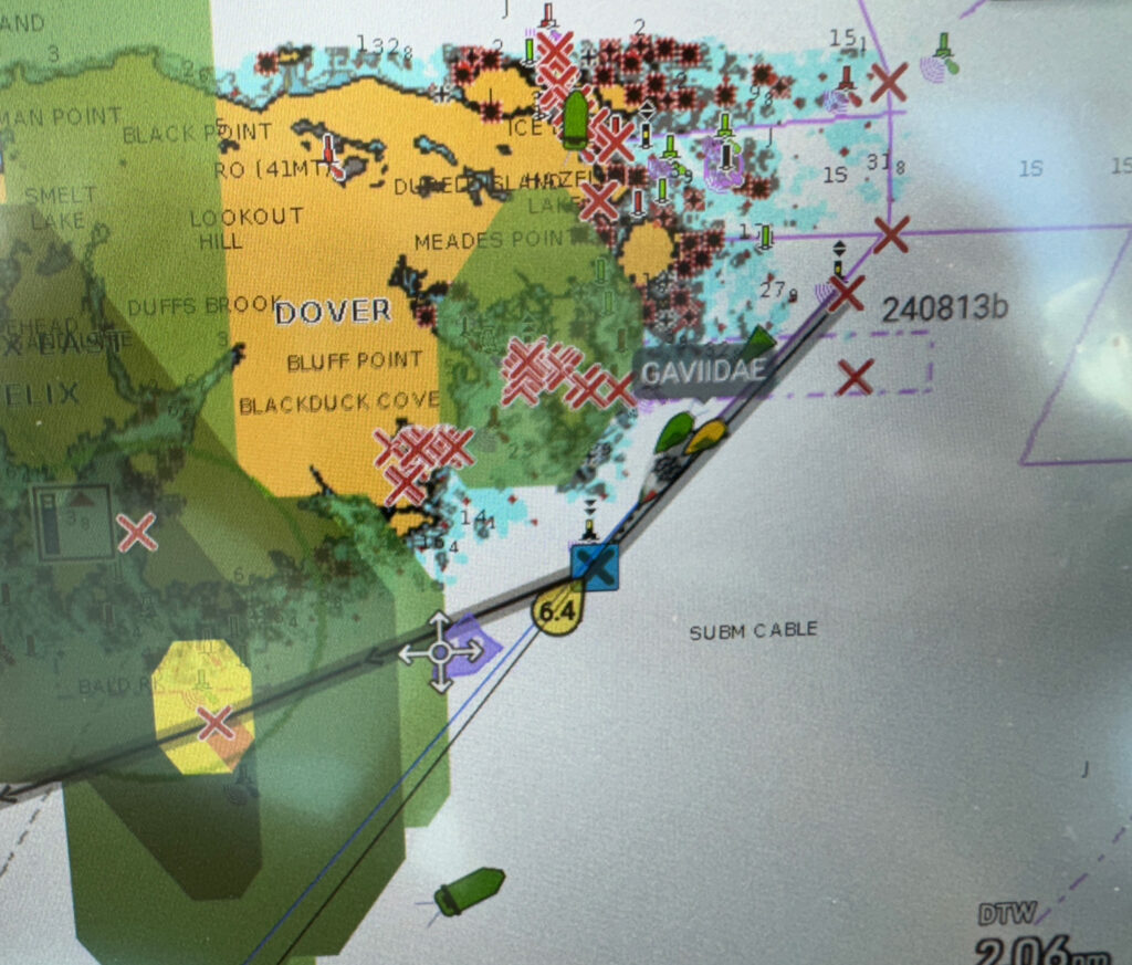
Louse Harbour
The fog lifted off the mainland about noon. Not long after coming out of the fog, brewing storm clouds ahead of us forced us to do a route change. We rerouted into Louse Harbour about 20NM shy of our destination. This was an anchorage that we’d not been in and the wave action at the outer entrance was a little intimidating. It looked like Gaviidae was going to do a little surfing along the shoals before getting behind any protection.
It looked worse than it was, but then, hindsight is always 20/20. We wiggled our way back into a small anchorage area that was owned by a large family of seals. Another sailboat was already anchored in the bay. It took a couple of attempts to get our anchor to stick in the kelp bottom. The seals voiced their opinions of our anchoring skills.
The storm brought in rain along with some lightning, but we were secure in our cozy anchorage. During the worst of the heavy rain, a couple other boats arrived bringing the total to five sailboats of various sizes.
Hurricane Lee
With our limited connectivity, we were able to glean that the tropical disturbance far off in the South Atlantic had become a named storm. Hurricane Lee was building and heading straight for Nova Scotia, based on the majority of weather models. It was expected to hit the large peninsula in five days or less! The safety of Shining Waters Marina in St. Margaret’s Bay was three to four days away, depending on local weather conditions.
Feeling immense pressure to get going and make up the distance lost the prior day, we routed a 73NM day. The weather had other plans and afternoon thunderstorms forced us to call the day short by 20NM. We dropped anchor near High Island where we had some islands between us and the ocean. Our selection turned out to be a poor one as big rolls came in as soon as the sun went down. I suffered a restless night in the rocking boat while Dan slept great dreaming of being in a giant rocking chair!
Rogues Roost
We had stopped at Rogues on our way to the Bras d’Or and a friend of Howard’s had told him he had to stop there. With fingers crossed that the weather would be kind, we set out on a 79NM day.
Our path took us across the shipping lanes into Halifax where Gaviidae 37 had to give way to a large container ship, and we got hailed by U.S. Warship #131 relaying their intention to cross our path. We requested permission to pass behind, which they promptly approved. We seem to encounter more U.S. military ships in Canadian waters than Canadian ships!
This time we anchored in the larger bay of the two bays at Rogues as there was already at least one boat in the smaller anchorage where we had been before. While enjoying the nice evening, a woman from SV Nordic Spirit paddled over on her SUP. We had followed them up the Eastern Shore when we went to the Bras d’Or, run into them again in Baddeck, and now shared an anchorage together. We had a nice chat before the mosquitos chased her and her dog back to their boat.
Tired from a long day on the water, both Gaviidaes had a quiet evening.
Shining Waters
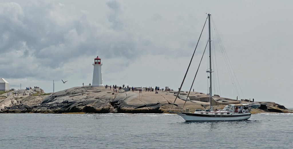
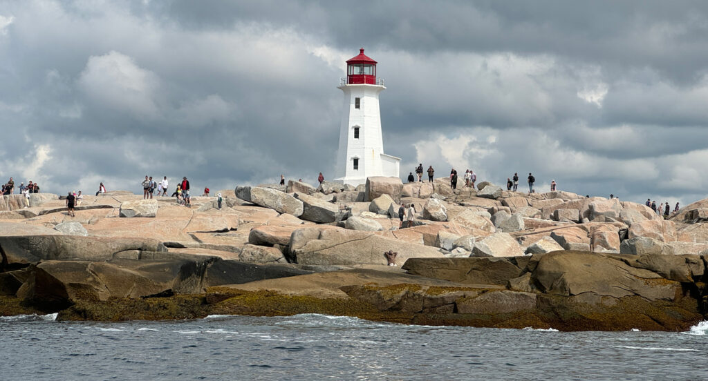
With a short 20NM hop ahead of us to Shining Waters, we slept in for the first time since we left the Bras d’Or. The latest forecasts for Hurricane Lee had started to indicate that it would track well to the east of Nova Scotia. The seas were calm and with bright sun, we finally got to see the lighthouse at the famous Peggy’s Cove. In fact, we took the path right along the shore, wiggling between the shoals.
The marina had posted on their website that they would make the decision by 9:00AM that day as to whether they would evacuate the marina. By the time we arrived in the afternoon, the staff were all smiles as the hurricane was going out to sea.
Playtime
With the worries of Hurricane Lee behind us, we proceeded to use the RV to do provisioning runs and play tourist. H&K joined us on these adventures. One trip was to the Halifax Seaport Farmer’s Market and expanded into a long stroll along the waterfront.
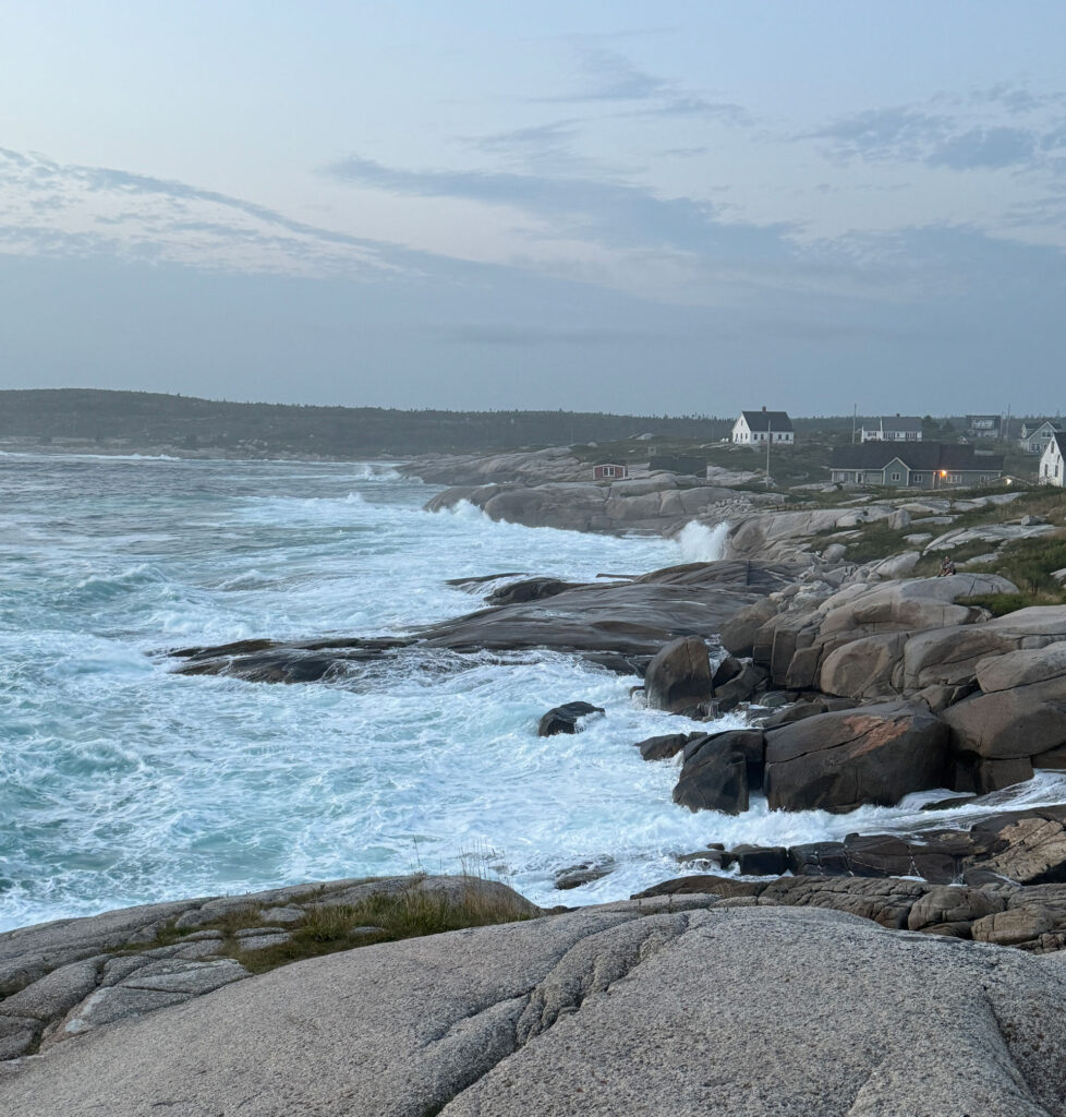
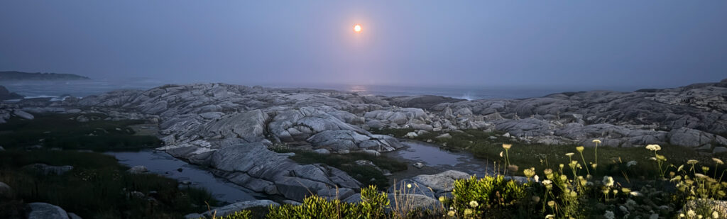
We went to Shaw’s Landing for a wonderful seafood dinner and then stopped at Peggy’s Cove to watch the sunset, the rise of the Super Moon and the huge waves coming in from the hurricane off in the distance. All were impressive.
July 28-August 16, 2024 523 Nautical Miles 44°39.523’N 063°54.820’W
For exact locations (latitude and longitude) for each stop, please visit our Map Page or our MapShare.
A fun read, Julie! Loved your tales of Cape Breton, a place Jim and I loved and meant to see again.