The old sea adage is that there are two types of sailors: Those who have run aground, and those that will. Last August Julie and I ran aground hard on rocks entering Old Dave’s Harbour at the west end of Otter Island. Otter Island is along some of the wildest and most remote sections of the Canadian shore of Lake Superior. This is on a 100 mile long section of the lakeshore that has no communication towers of any sort, and unless there is another boat in the area, out of VHF range. Satellites are the only means of communications. If you do not have a satellite phone, you are out of touch with the modern world.
A storm was brewing on the lake as we entered Otter Head at the east end of Otter Island and it was early evening. Water visibility was not optimum. We also had incomplete information about the channel into Old Dave’s. Two shoals obstruct the channel. They do not meet nose to nose, rather, they are slightly offset from one another in a yin/yang sort of way. Getting by them requires a shallow “S” maneuver—from the bottom of the S up to enter the harbor and vice versa to get out.
It took us over two hours to get off the rocks—and that required the help of the surging storm out on the lake. It sent in a seiche—Lake Superior’s version of a tide—that lifted our keel off the submerged boulder it rested on and allowed Julie to power up and move away from the taller boulder that incoming waves had been holding the keel against. Nothing I had tried from the dinghy—including various attempts to kedge off the rocks with the dinghy and with the anchor—had been successful and dusk was rapidly approaching. But we got off the rocks and safely into the harbor where we sat out the storm for three days.
We did not waste our time there. We explored Old Dave’s end of the island, with its decrepit fish camp which was last used in the 1950s.

We also visited the automated lighthouse and the abandoned head lighthouse keeper’s residence at the west end of the ridge that runs along the south side of the island. The assistant lighthouse keeper’s house sits next to a concrete pier on the harbor. We also made a futile attempt to reach a Pukaskwa pit that we could see from the ridge, but could never get to. A Pukaskwa pit, pronounced puck-a-saw, is a depression in the ground lined with white stones for unknown reasons by people who lived in this area long before the First Nation tribes settled in Canada. Nobody knows who they were or when they were there. All that remains are these mysterious pits—many of which line sections of shoreline. Some are found short distances from shorelines. We attempted a couple different approaches, but never found that pit.
We also carefully surveyed the channel into the harbor from our dinghy while we waited out the storm. While we captured the track to and off the eastern shoal that impeded our entry, we used the dinghy anchor to plumb depths and determine the best channel in. I learned that short but treacherous channel well enough to do it in my sleep. Which is why Julie and I became Great Lakes Cruising Club port captains for Old Dave’s Harbor, and how we decided to return to the scene of the crime a year later.
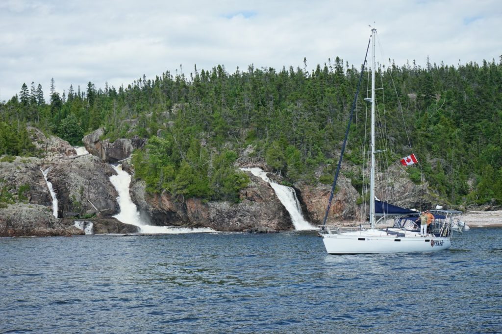
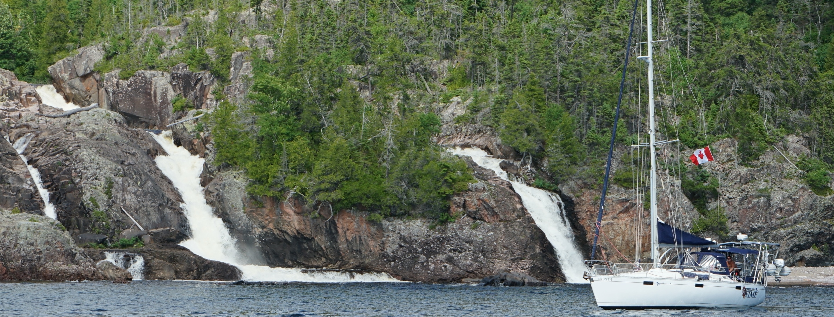
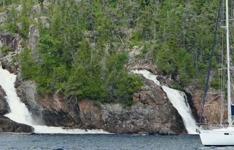
This time we cruised there with Dave Steele and his buddy Moe who were aboard Dave’s Beneteau, Steele‘n Time. Dave has been to Otter Head numerous times with his family. It was Dave who urged us to visit Old Dave’s Harbour in the first place. Before we attempted the channel into the harbor, we cruised across Otter Head channel to photograph each other’s boats with Cascade Falls in the background.
Weather had prevented Julie and me from taking the dinghy over to the falls last year, so this time around we got a take a closer look at these gorgeous natural waterworks.

On completion of the photo op, we cruised both boats into the harbor without incident. While Julie and I anchored in the harbor and set a stern anchor in the small harbor, Dave took Steele‘n Time out through the really rocky and dangerous channel underneath the lighthouse. Our friend from Batchawana Bay is fearless—and has been to Otter Island enough to know all the nooks and crannies deep enough for a sailboat with a 5-foot draw—even though he hasn’t been there for years.
We rafted up for the night, then Steele‘n Time set out the next morning to explore the east shore. Dave and Moe both needed to be back home Friday. Julie and I trekked up to the lighthouse to leave new log books, pens and boat cards for future visitors. As port captains, we took it upon ourselves to allow future visitors to log in and comment on their visit not only in log books that Julie bought, but a way to log into a site online and write about their visit once they reconnected to the internet.
We stayed three days. On the third day Julie and I dinghied down to the east end of Otter Island and around to a cove on the south shore to search for what are reported to be some of the most spectacular Pukaskwa pits known. After several false starts looking for a trail to the pits, we found the way in. It required some scrambling and a little meandering without a map or a trail, but we finally found the terraced levels that lead up to the main area. Pukaskwa pits at last!

A low wall of stacked rocks a couple hundred feet along the east side fronted what had once been a waterway that divided the island aeons ago, when Lake Superior was much higher and bigger. Two small lakes below the pits are all that remain of that passage. The other side of the main paved area ends at the foot of a tall cliff. This main area comprises about an acre. Within that area are several obvious depressions or “pits” about a foot deep and from four to six feet across. The entire paved area, including the terraces, totaled about two acres! The whole thing is absolutely amazing and well worth the time and effort to get to.
After a very wet and cold ride back to the boat directly into the teeth of a rising westerly wind, we got dried off from the spray and began preparing dinner. I happened to step up into the cockpit to get something out of the cooler when I saw another sailboat leaving the harbor. As we quickly surmised, Country Dancer, a Catalina 47 had entered the harbor and decided it was too small to accommodate two sailboats. We hailed them and told them there was plenty of room if they tied to shore or dropped a stern anchor. I helped them tie to shore and we had them over for an Italian sausage spaghetti dinner. Gary and Jodi hail from Sarasota, Florida, and had been cruising the wild side of Lake Superior after spending the winter aboard their boat in Spirit Lake, near Duluth.
Jodi is originally from Duluth, and they cruised there to visit family and friends. They are currently working their way back to Florida by way of Chicago and the Mississippi River. We left for Michipicoten the next morning and expect to run into them again as we work our way back to Sault Ste. Marie and Lake Huron.
On the way out of Otter Head, we detoured up into Otter Cove on the mainland. We had heard the place was well protected and features spectacular rock cliffs along the west side of the cove. It’s also home to loons. Always worth finding a place where loons like to spend the summer.
July 12 – 15, 2016 48°06.810’N 86°03.755’W 477.3 Nautical Miles


What an incredible place to sail! Wow! Well written, I could visualize everything. End of summer is coming. Cannot wait to see where you end up before it gets too cold!
Rendezvous was spectacular missed you guys
Du and Mar
Had a little ride on a smaller version of your boat – 31 knots! Got my hair dry really fast! Miss you both!
Thanks Dan, interesting stuff. So glad you didn’t leave the keel behind.
Hey, Dan! This is a great read. You two are having such fantastic adventures,and I really appreciate hearing about them. Two of my favorite subjects—mariners and anthropology! Love, Lynne